- Consultation
- Street Trees and Bus Shelters
- Newcastle City Council Update | 8 January 2018
- Newcastle City Council Update | 9 February 2018
Newcastle City Council have published their final plans for the Broadway to Brunton Cycle Lane and construction is due to start soon in a series of phases to minimise disruption.
As we said in our review of the initial consultation, residents’ feedback showed that there was broad support, with most people agreeing with the aims of the scheme but with a number of detail points that needed addressing. In this blog we take a look at the consultation process and the changes made by the Council as a result of that feedback.
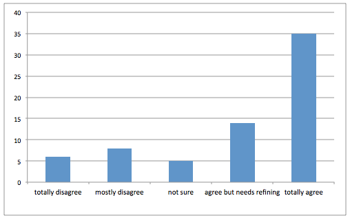
Residents’ feedback on the proposals from the Commonplace website.
The new cycle route should be suitable for residents of all ages and abilities and, apart from two short sections, the use of shared space where people walking and cycling are expected to use the same space has been avoided. The new crossings will make it easier for local residents to cross the Great North Road, especially at the Three Mile Inn where currently there is only a footbridge that is not useable for people with mobility issues.
As well as increasing the choice for how people can travel, wider benefits for the community include better health for those who walk or cycle, better air quality for everybody and fewer cars on the road for those who travel by car or bus. The new cycle lanes will also help people access local shops and potentially allow families to cycle to schools, including Broadway East following its proposed relocation to The Great Park. Current middle and high schools for children in this area are all south of Broadway and there are no alternative routes.
“Fly through” video of the original proposal produced by Newcastle City Council.
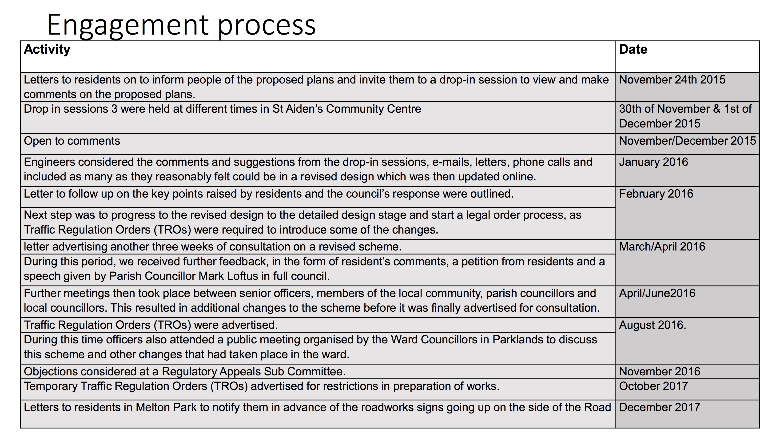
The initial consultation, based on the City Council Transport Development Process, was via the Commonplace website at the end of 2015 where comments can still be viewed. In addition the Council held three community drop-in meetings in Brunton Park where residents could submit comments on paper forms. According to the engagement report over 900 people visited the Commonplace website with 120 attending the drop-ins.
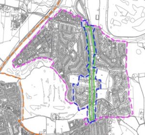 To publicise the consultation the Council sent letters to everyone living in Brunton Park, Melton Park and Melbury (the purple boundary on the map) as well as to statutory consultees including local councillors, MPs, emergency services, bus and taxi companies, disability groups, walking and cycling groups (though not SPACE for Gosforth), the Federation of Small Businesses and the Chamber of Commerce, the Freight Transport Association and the Road Haulage Association.
SPACE for Gosforth also shared a blog with some thoughts on the proposals via our Facebook, Twitter and other local social media sites.
Local councillors in the Parklands ward shared news on the proposal via the Parklands Focus newsletters, reporting in issue 41 on a meeting supported by the Council transport department that was attended by 150 local residents. Further updates were provided in issues 42 and 43.
We also know that North Gosforth Parish Council discussed this matter regularly at their meetings and met council officers on a number of occasions to discuss the entrance to the service road and other concerns. Minutes of parish council meetings are posted on community noticeboards.
There was further opportunity to comment in August 2016 when the Council sought views on an amendment to the entrance to the GNR service road north of Polwarth Drive to respond to concerns raised by residents on that road.
A separate consultation was held for the toucan crossing by the Three Mile Inn in November 2016, which SPACE for Gosforth also wrote about here. This consultation, in part because of concerns about the adjacent footbridge, was also shared widely on social media and via two Chronicle articles: Fears over plan to ‘axe’ Gosforth footbridge crossing one of Newcastle’s busiest roads and Community is divided over plans for pedestrian crossing at key city route.
For both the cycle lane and toucan crossing a further and final stage of consultation was held on the legal traffic orders. At this stage letters were sent to those directly affected by the works (in the blue boundary on the map), residents with whom the Council had discussed plans, as well as to statutory consultees, with adverts placed on local lampposts and in the local press and on-line via the Let’s Talk Newcastle website.
Objections submitted at this stage were considered by the Traffic, Regulatory and Appeals Sub-Committee (RASC). The minutes for these meetings can be found here for the cycle lane and here for the toucan crossing. This completed the consultation process.
Design Changes
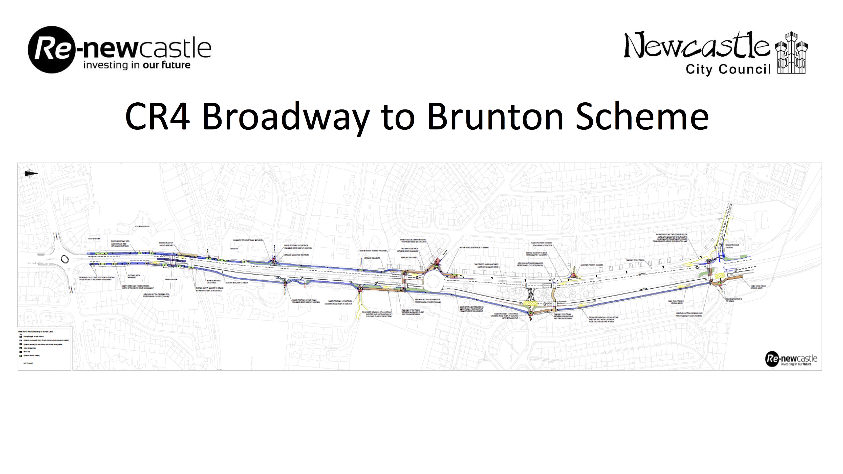
A number of design changes were made to the scheme as can be seen by comparing the initial design, available here, with the final version published on the Council website.
Two overall changes have been made. One is that the final plan does not include the original proposal to reduce the speed of this road to 30mph from 40mph, although a 30mph limit will be in force during road works. We believe the Council still intend to do this but via a separate proposal.
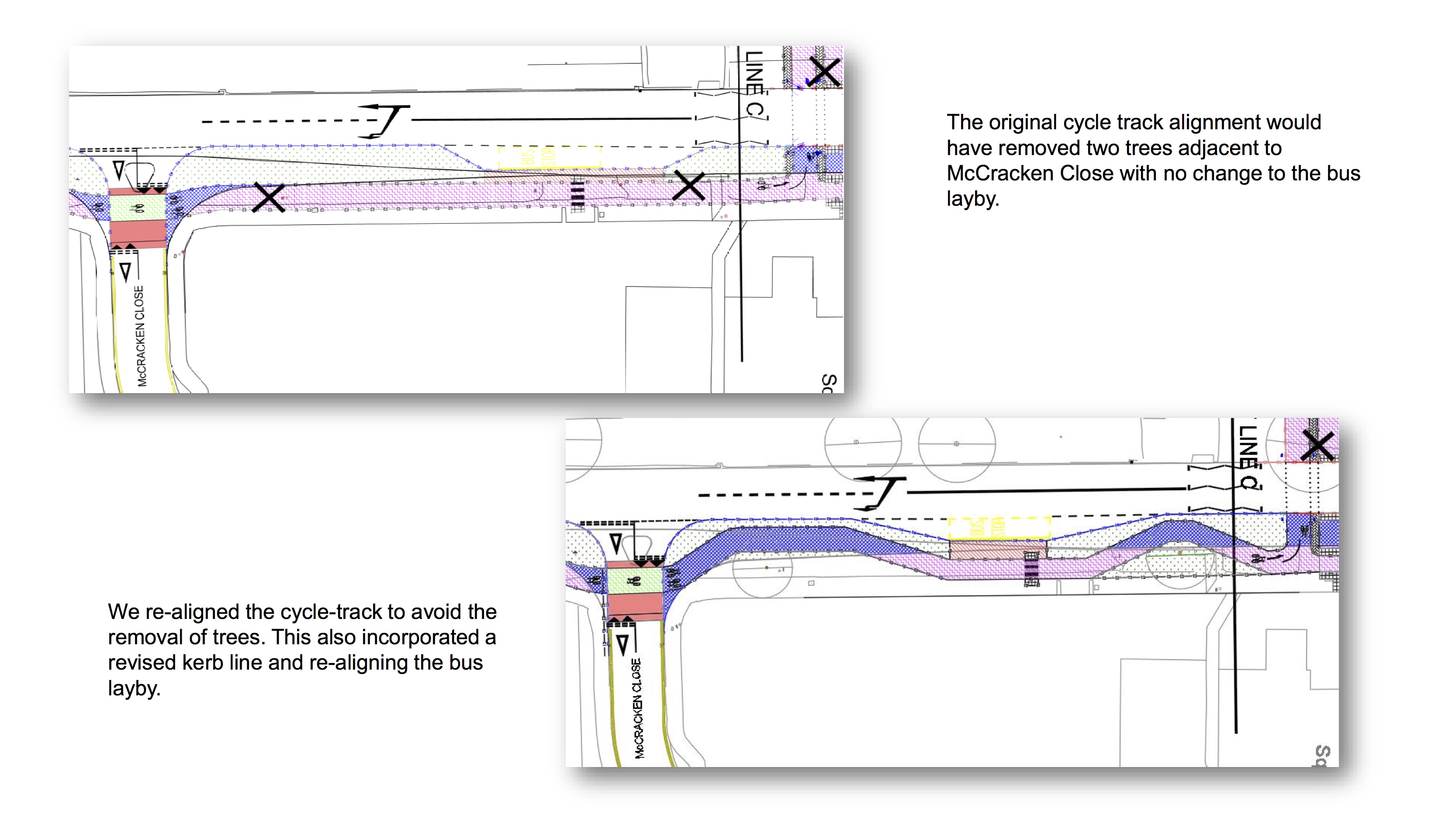
The second is that in a number of places the cycle lane has been re-aligned to be alongside the footpath although still in its own space. We understand this was partly to reduce costs but also helps to minimise tree loss across the scheme. It will also make it more comfortable for people cycling being further away from traffic.
The Three Mile Inn Toucan Crossing
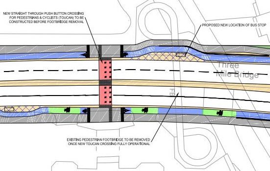
The following plan was published as part of the consultation for the Three Mile Inn Toucan crossing to help people cross who are unable to use the bridge due to mobility issues and for those that wish to cross with a cycle. This also showed updated plans for the adjacent bus stops and a statement saying that the footbridge would be removed once the Toucan crossing is installed, though the consultation itself was only in relation to the crossing.
In this original plan, additional pavement space was included for people waiting for or alighting from buses. People walking or cycling past the bus stops would go behind this new pavement with continuous lanes unlike further south where the space behind these boarding areas is shared. Although relatively new for Newcastle this arrangement is thoroughly proven in other UK locations and in countries with more established cycling cultures.
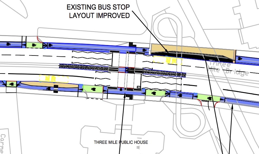
The final plans however show that the footbridge will not be removed as part of this scheme, no doubt in part due to the Keep Our Three Mile Footbridge Petition. If the footbridge requires maintenance or removal in future this will have to be funded out of general council budgets.
While the south-bound bus stop design is unchanged, on the north-bound side the separate lanes have been merged to be shared as the support struts for the retained footbridge mean there is insufficient space for separate walking and cycling paths. This appears to be an inadvertent negative consequence of the petition, although if the bridge is removed in future it would be possible to reconfigure this area to have separated space as was originally planned.
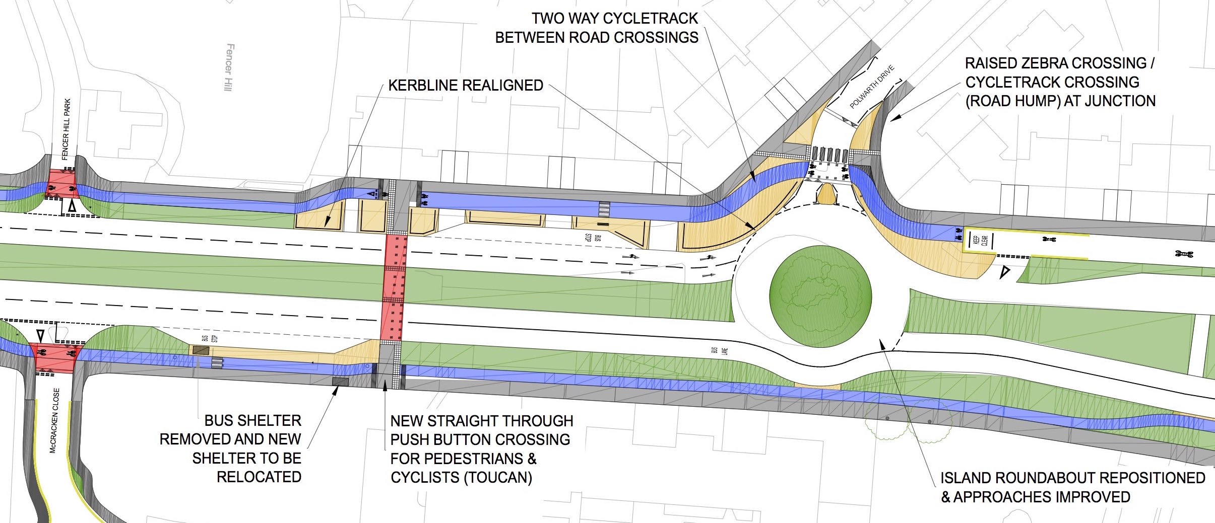
McCracken Park to Polwarth Drive
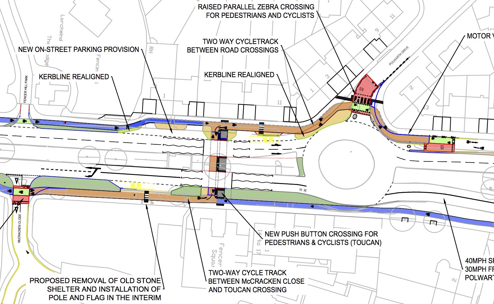
This section is the most changed between the original and final plans. Comments on the original plan focused on car parking for residents living south of the roundabout, lack of (and provision of) two way cycling and access to the service road. The latter was a subject of a petition documented in the Chronicle Petition against ‘dangerous’ Great North Road cycle route to be heard by Newcastle City Council.
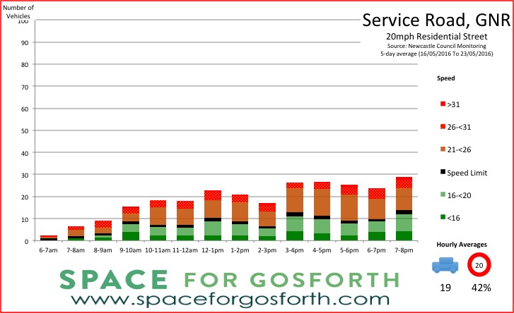
The Council, we know, had a number of discussions with residents of the GNR service road about access. Following an automated traffic count that showed very low volumes of traffic, the Council agreed to leave this open for access but with a raised hump to slow vehicle speeds off the roundabout to ensure safety of all who might be cycling.
The final plans also show:
- On-street parking provision south of the roundabout.
- The toucan crossing now has dedicated and separate walking and cycling paths rather than shared space and is moved slightly closer to the roundabout. This means the south-bound bus stop is slightly closer for people coming from or going to Brunton Park.
- An extension to the 2-way cycle lane to McCracken Park so people leaving McCracken Park can travel directly to Brunton Park and not have to go via the Three Mile Inn crossing.
- The geometry of the roundabout has also been changed to reduce the speeds of vehicles entering Polwarth Drive from the south.
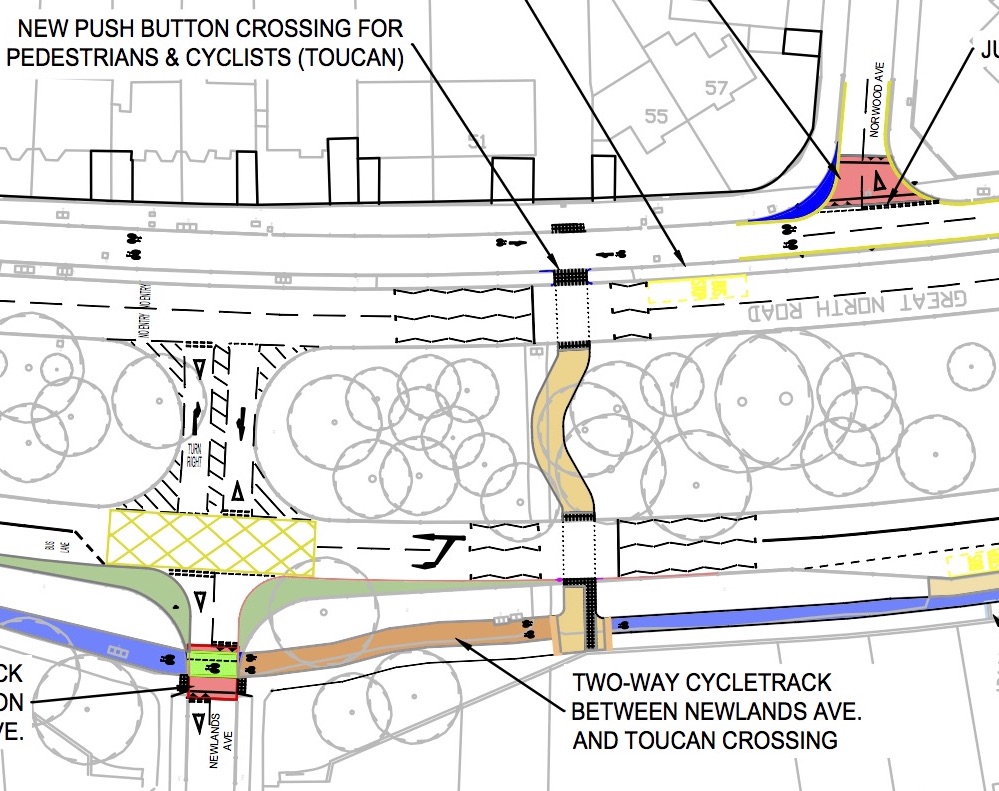
Newlands Avenue to Norwood Avenue
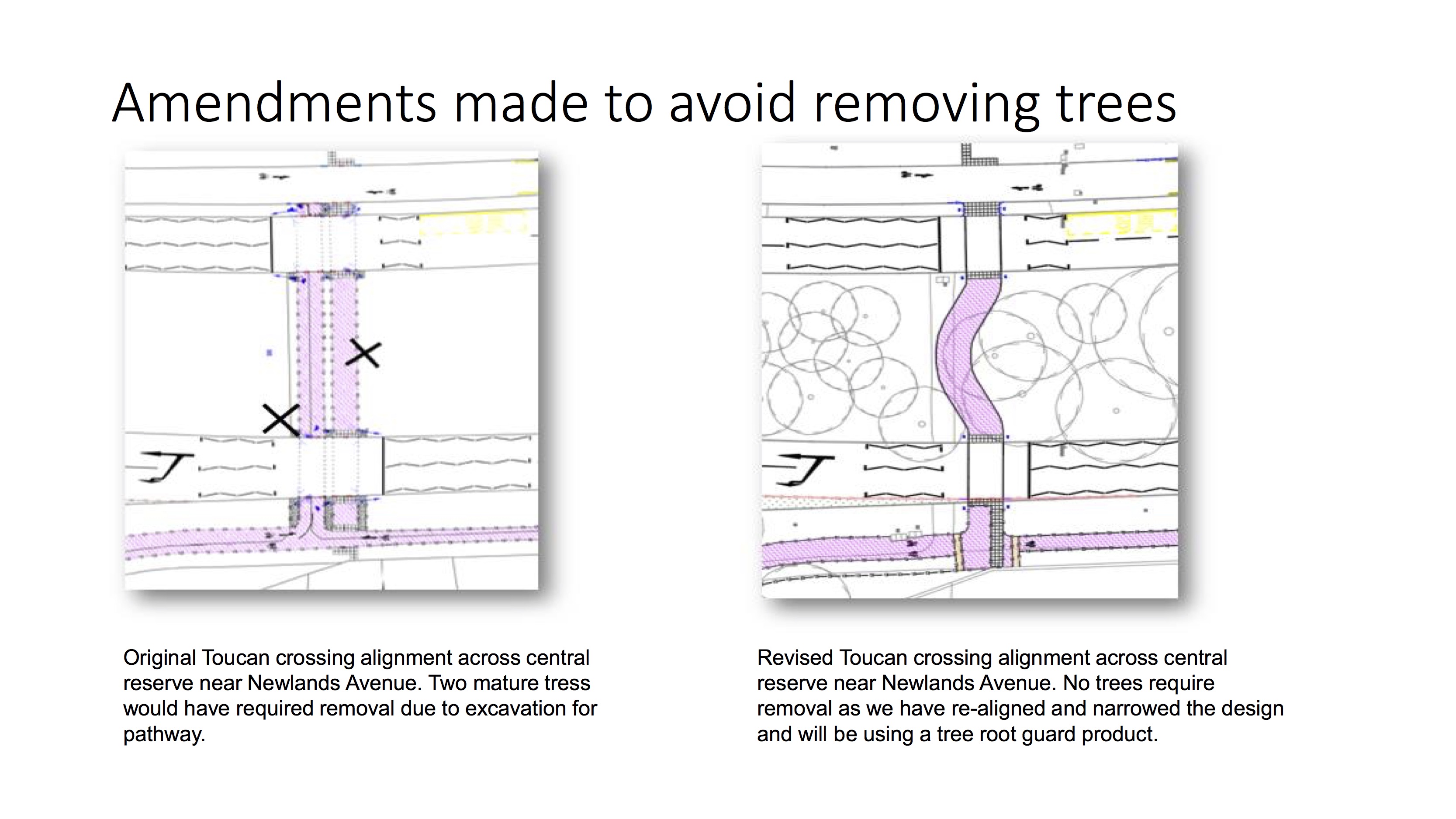
The GNR crossing between Newlands and Norwood Avenue is the other part of the scheme that uses shared space. This has been retained to avoid tree loss at this location that would have been required with a wider separate paths. The wiggle is for a similar purpose to route the path around an existing mature tree.
In addition, there is a new section of 2-way cycle track to allow people from Newlands Avenue to travel north directly rather than have to go south first via the crossing south of Polwarth Drive, which would have been a considerable diversion.
Brunton Lane
At Brunton Lane the shared space on the crossing has again been replaced by separate cycle and walking paths. In addition footpaths into Glamis Avenue that were shown as being removed in the original plans have been retained. The only other difference is a minor change to the west side of the crossing so people cycling are directed straight onto the service road.
Requests for change not incorporated into the final plans
Not all feedback led to changes. In considering feedback, council officers have to take account of safety and comfort of road users (especially vulnerable road users), council policy, scheme objectives and budgets. Even if a proposed change is extremely popular it still might not be accepted if, for example it might put some groups in danger or cost more than is available in the scheme budget.
The table below sets out the main requests that were not taken forward and the reasons for that decision. As a number relate to one-way vs two-way cycling, it is worth noting that in cities and countries where cycling is more established, a road this wide would almost certainly have two-way cycle tracks on both sides of the road so that people cycling always have a direct route without having to cross the road (and potentially require traffic to stop) multiple times.
| Request | Reasons changes were not made |
| Retain the slip road to Greystoke Park |
|
| Make the cycle path on the east side of the GNR two way. |
|
| Retain one-way only cycling on the service road. |
|
While the formal consultation finished in March 2017 with the RASC meeting for the Three Mile Inn toucan crossing, late changes have been sought in the last few days before work is due to commence by individuals running a local Facebook group in relation to two stone bus stop shelters marked for removal and, according to their site, 13 trees of which about half would be scheduled for removal in any case due to being in a poor condition. [See Update 8/1/2017 below for Council figures relating to trees]
At this late stage we believe the Council has no duty or obligation to take these points into account. Almost certainly contracts will have been signed for contractors to undertake the work, and equipment and other resources scheduled to be ready for work to commence. Any delay at this stage could increase costs for the Council, which may need to be funded by local taxpayers.
Having said that, if it is possible for the Council to consider these points without delaying completion of the scheme or incurring additional costs for taxpayers then we have no reason to object to that. Street trees in particular are an important part of the character of Gosforth and can help mitigate a number of the public health issues suffered by residents as a result of an excess of traffic. If it is possible to retain healthy mature trees then we would support that.
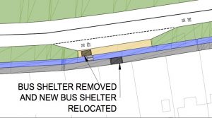
Extract from the original plans
It is worth noting that both issues were considered as part of the consultation. The two stone bus shelters were specifically marked for removal and trees were mentioned by quite a few residents in their feedback mostly (but not all) in favour of retaining trees where possible.
We hope therefore that the Council will be able to present a reasoned and balanced view as to why these aspects of the scheme are as proposed so that we can all be properly informed as to the pros and cons of retaining the existing street trees and bus shelters vs replacing the bus shelters and planting additional trees to replace those that would be removed.
Lessons
Our main disappointment on this scheme is that it has taken so long from the original consultation to work commencing. With significant benefits promised, certainly compared to comparable more expensive traffic schemes, and with broad community support it should be expected that the work could have been complete far quicker. The city of Seville in Spain transformed its entire city in less time, with 50 miles of new protected all-ability cycle lanes and an eleven-fold increase in cycling.
That said, the incorporation of feedback into the scheme has clearly led to improvements compared to the original plans and we support the importance of the Council engaging with residents to seek input and support. There will always be calls for more communication and engagement, both of which we support, however we also recognise that there must be a point of diminishing return beyond which the cost of further consultation will outweigh any potential benefits.
Ultimately there is a need for leadership by councillors and council officers to learn these lessons to make sure future schemes are designed in a consistent manner both to meet best practice and to take into account known issues of community interest and concern.
Just as importantly we need leadership to create a sense of urgency to resolve issues with air quality, health and a lack of choice for how we travel that are currently designed into our environment.
Newcastle City Council have released a statement published in the Chronicle which clarifies the number of trees affected and, which relate to the cycle route and which are to be removed for unconnected reasons:
“We have designed dedicated cycle facilities on the Great North Road, between Broadway and Brunton Lane, in order to make the area – a well-used cycle route, including by people riding to schools – safer for those on bikes.
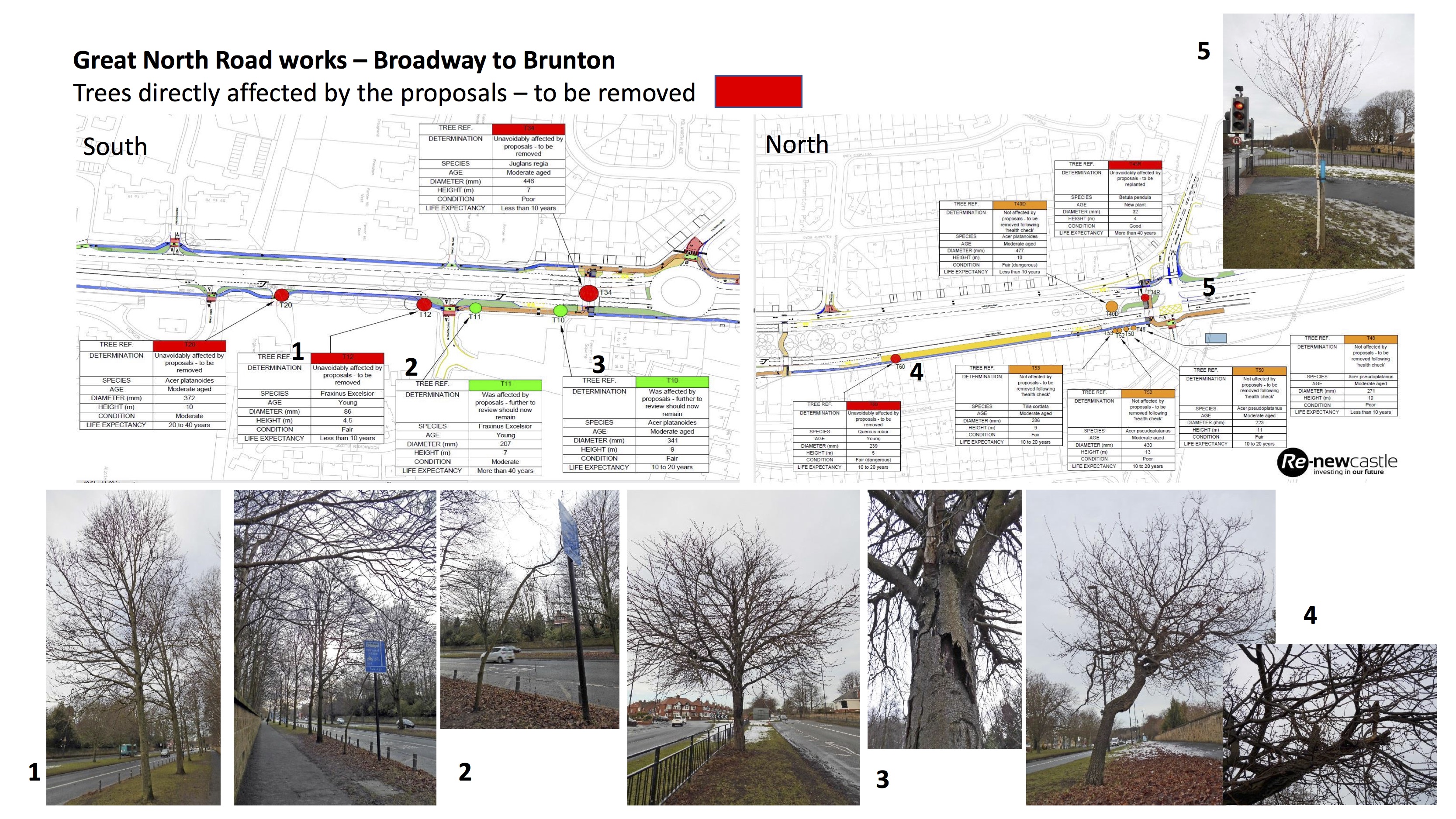
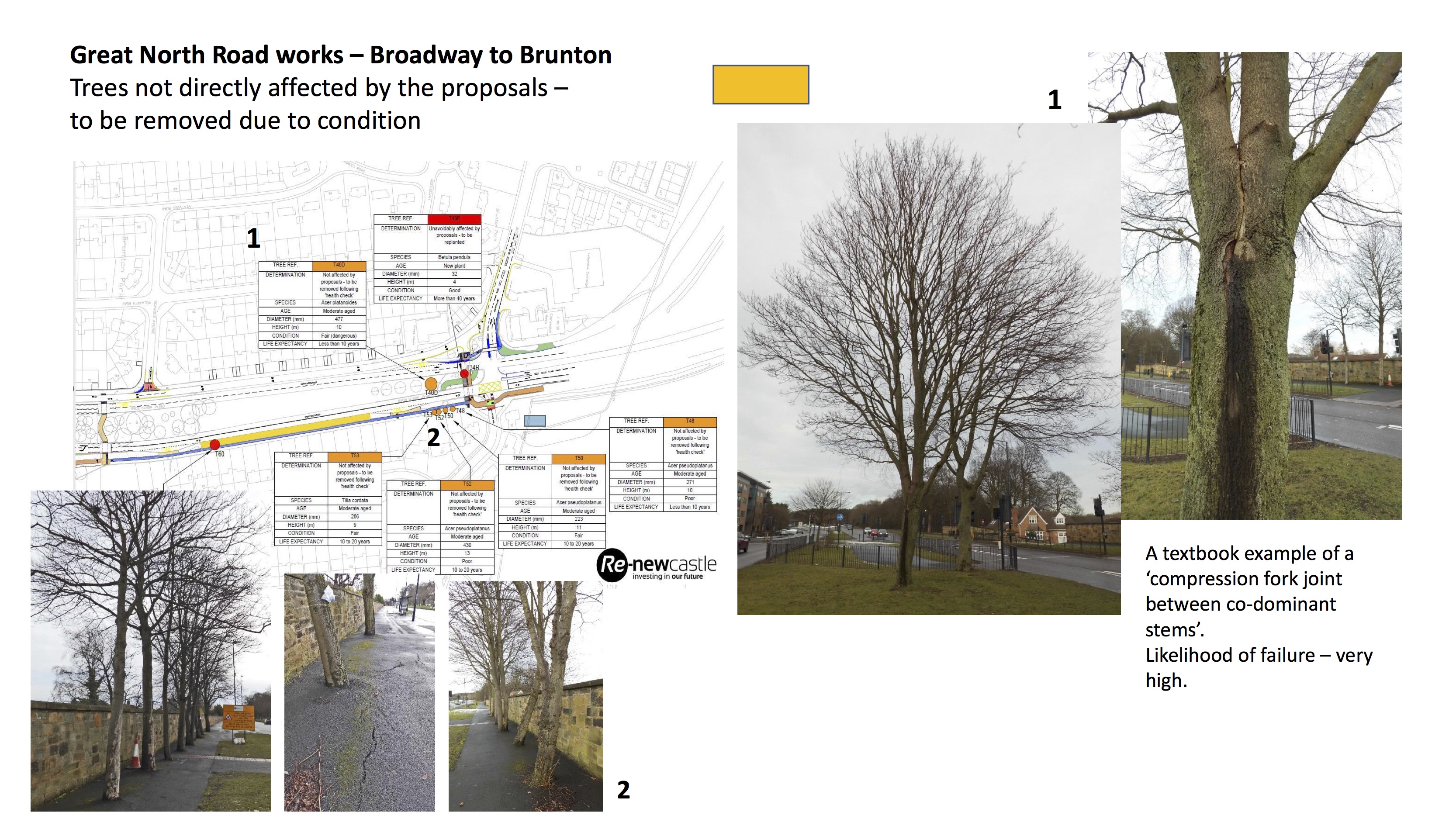
“As part of the development we have identified that three trees, of differing ages and quality, would need to be removed for the project. A further eight trees, while not required for the project, may also be removed for other reasons, one of these trees we consider to be dangerous due to its condition.
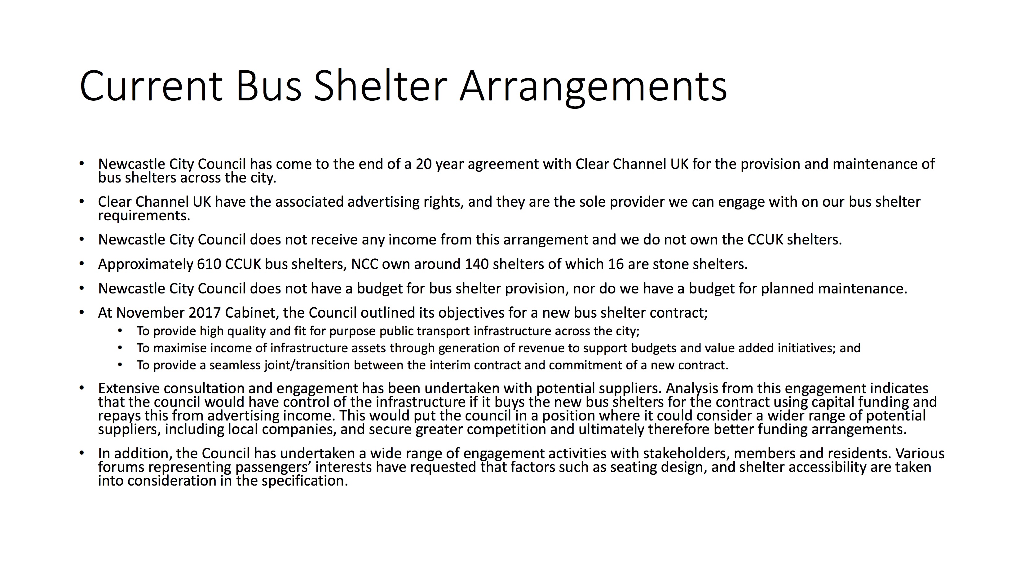
“Two stone bus shelters, which are unpopular with many passengers – though apparently popular with others in the community – would also need to be removed and would be replaced by shelters that include seats.
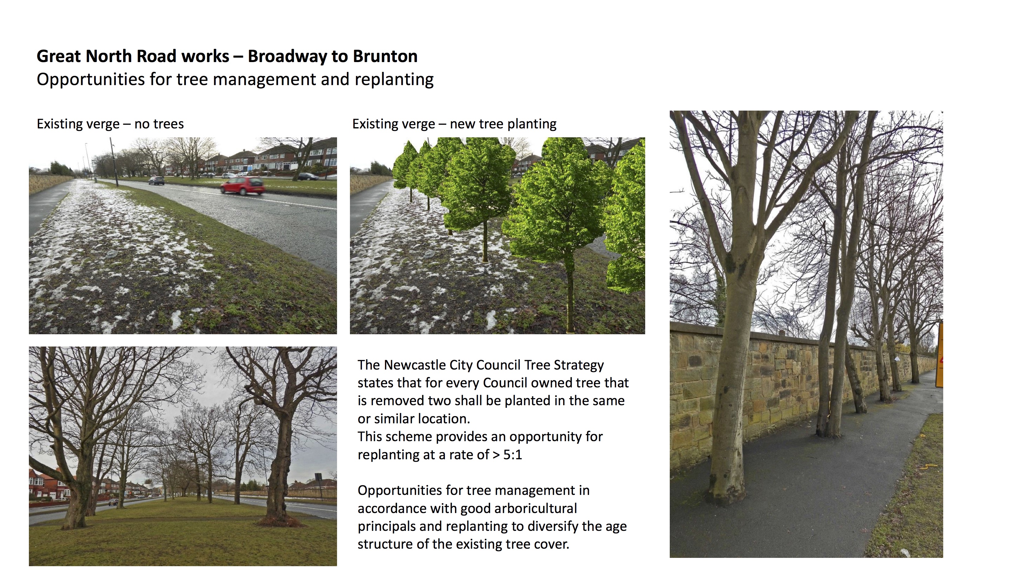
“One of the three trees that need to be removed is a very young tree that we would replant and we would then be planting two more trees for every one that is removed.
“A petition from people objecting to the loss of trees and bus shelters will be presented to a meeting of the city council on Wednesday [10 January 2018]. Work will not start until after councillors’ response to the petition has been taken into account.”
On Tuesday 24 January SPACE for Gosforth attended a meeting organised by Newcastle City Council in response to the Gosforth Traffic Facebook page petition relating specifically to the removal of trees and the two stone bus shelters on the east of the Great North Road.
This is the Council’s update giving a summary of actions agreed at the meeting including the opportunity for the North Gosforth Parish Council to adopt the stone bus shelters and a number of other points raised by residents during the meeting. The update also includes copies of the slides presented at that meeting.
Further information and updates are available from the City Council website for the scheme. Work on the scheme started on Monday 29 January, initially including the introduction of a temporary 30mph speed limit and application of new lane markings on the road.
Broadway to Brunton Update February 2018
A petition, organised by Gosforth Traffic, a social media community site, that challenged the removal of trees and stone bus shelters was presented to the January meeting of the City Council. At the direction of Cllr Ainsley, Cabinet Member for Transport and Air Quality, a meeting was subsequently arranged between council officers and local ward councillors, petitioners, and other community groups who had been in touch about the Broadway to Brunton scheme including Save Newcastle Wildlife and SPACE for Gosforth.
The actions arising from the meeting on Tuesday January 24thwere:
- to have a site meeting on Newlands Avenue with local residents;
- to investigate an alternative compound location;
- to consider fencing off around the group of 9 trees on the eastern side of the carriageway in the vicinity of Glamis Avenue;
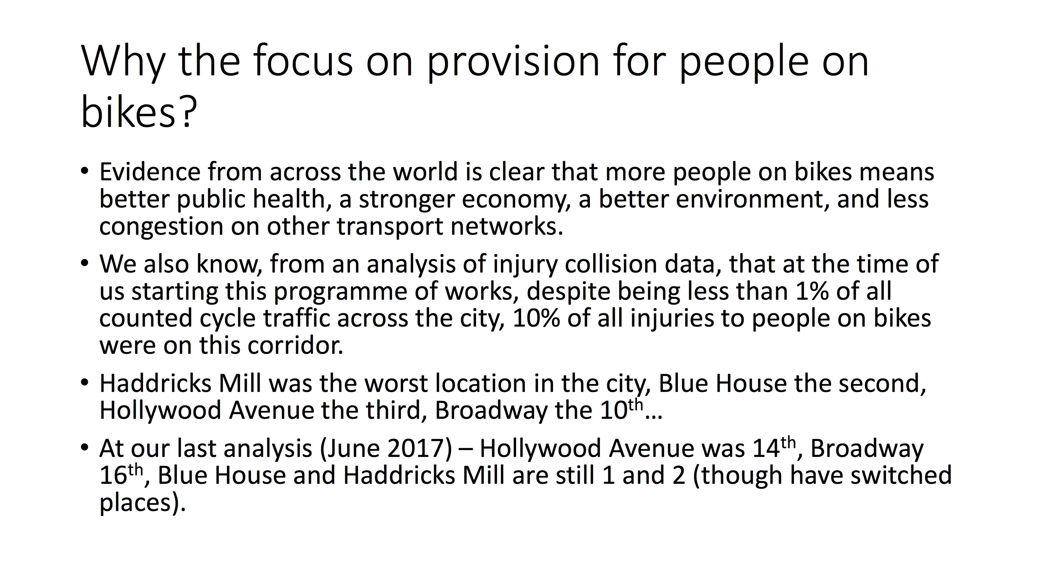
- to provide background data on collision statistics;
- to contact the Parish Council regarding the potential for an asset transfer of the stone bus shelters; and
- to consider writing to all local residents to inform them of the scheme and what would happen next.
Following this meeting, and the subsequent site meeting we have had further correspondence by email and have responded below.
Whether or not all residents in the surrounding area will be sent a letter to provide them with a full update on the scheme?
At this point, no they will not. We will be posting information online and also providing updates to people whose email addresses we have. We will be sending out further updates about the scheme as we progress to future phases of works.
Can we use an alternative site compound?
Yes, an alternative site compound is being used.
What is the timeline for removal of trees?
The trees are currently programmed to be removed in the week commencing Monday 12.02.18 (weather and existing workload permitting). Even if not removed next week, all trees that need to be removed, will be before the end of February.
The sapling located in the central reserve that was identified for replanting was replanted on Monday 05.02.18. Following further investigations, another tree has been identified for removal, this tree is not being removed to facilitate the scheme, it is being removed due to structural defects making it potentially dangerous. This is a tree at the entrance to Melton Park / Newlands Ave and was identified when council arborists were on site in the two weeks following the meeting.
The survey of the central reservation trees as discussed at the meeting will be undertaken when the funding is confirmed, hopefully during the summer months and any removals and replanting, plus the east verge planting, will take place during the next planting season November 2018 to February 2019.
What information is available on trees?
Please see presentation slides attached. As noted above an additional mature tree adjacent to and south of Newlands Ave junction has been identified as being in a dangerous condition and will require removal at the same time. As discussed at the meeting, the Council will also remove the tarmac around the group of 9 trees and fence these off for the period of the works to support them.
What is the situation with the bus shelters?
As discussed at the meeting, the Parish Council are keen to explore taking on responsibility for these shelters. Since the meeting, Officers have been in touch with a Parish Councillor who was at the meeting and a briefing pack has been issued to all Parish Councillors earlier this week.
At the site meeting, residents discussed their concerns over changes to the height of crossing over Newlands Avenue – has anything been done?
Following on from the site meeting, we do intend to install the raised table at Newlands Avenue but with amendments to the design to take into account comments we have received. The raised table will now have a 14m long approach ramp that will only provide an increase in gradient from 6.3% to 6.8%. To mitigate this marginal increase we will resurface the carriageway in a material with higher skid resistance than the existing road. In addition, we will review the requirement for a grit bin in this location when we undertake our annual review of bin locations in preparation for the following winter.
Residents have concerns about the specifics of the design giving indication that people on foot or bikes have ‘priority’ as they pass over the junctions. Why is the Council providing this priority?
The type of crossing proposed at Newlands Avenue, where people on foot and bikes do have priority, can be found in many UK and European cities and elsewhere in Newcastle. We are trying to promote a more tolerant mix of road users, where vigilance and awareness of our most vulnerable is expected and understood. Such measures help to reduce speeds and the principle of slowing motor vehicles at crossing points to and from residential areas is reasonable.
Why is the Council not undertaking an Experimental Traffic Regulation Order (ETRO) to remove the bus lane during the works or change the operating hours to being peaks hours only?
It is important to note that an ETRO is only an appropriate use of power if there is the intention to make the Traffic Regulation Order permanent at the end of the ‘experiment’. Bus Lanes are in place to enable buses to get priority and are generally placed in locations to enable advance access to key junctions. The review of bus lanes we’ve recently undertaken does not recommend moving toward operation only in peak hours however despite this we note your request and will give it further consideration during the period of the delivery of this scheme.
Why are bus lanes out of action?
As noted at the meeting, the first elements of work are to remove the road markings and then re-lay them. We cannot do this work in live running lanes so the lane has been suspended while our sub-contractors undertake this work to remove, and then re-apply road markings. When this is done it will have created sufficient space for us to keep the running lanes at two for the majority of the work.
What is the work you have been doing in the past week?
We have been preparing the eastern side of the carriageway for the installation of a cycleway, in line with the scheme designs. The petition and subsequent discussions have been on aspects of design and the future of the stone shelters.
Please can we have a breakdown of costs?
Please see the Finance section of the report that accompanied the Delegated Decision.
http://democracy.newcastle.gov.uk/documents/s121681/REPORT.pdf
Where is the funding coming from?
Please see the Finance section of the report that accompanied the Delegated Decision.
http://democracy.newcastle.gov.uk/documents/s121681/REPORT.pdf
Please can you explain the increase in costs?
We do not agree that there has been an increase in costs. The scheme has been estimated at various stages and an appropriate contingency level given at each stage. The report referenced above outlines the cost of the scheme.
Please can you provide the data that you using to justify the safety improvements?
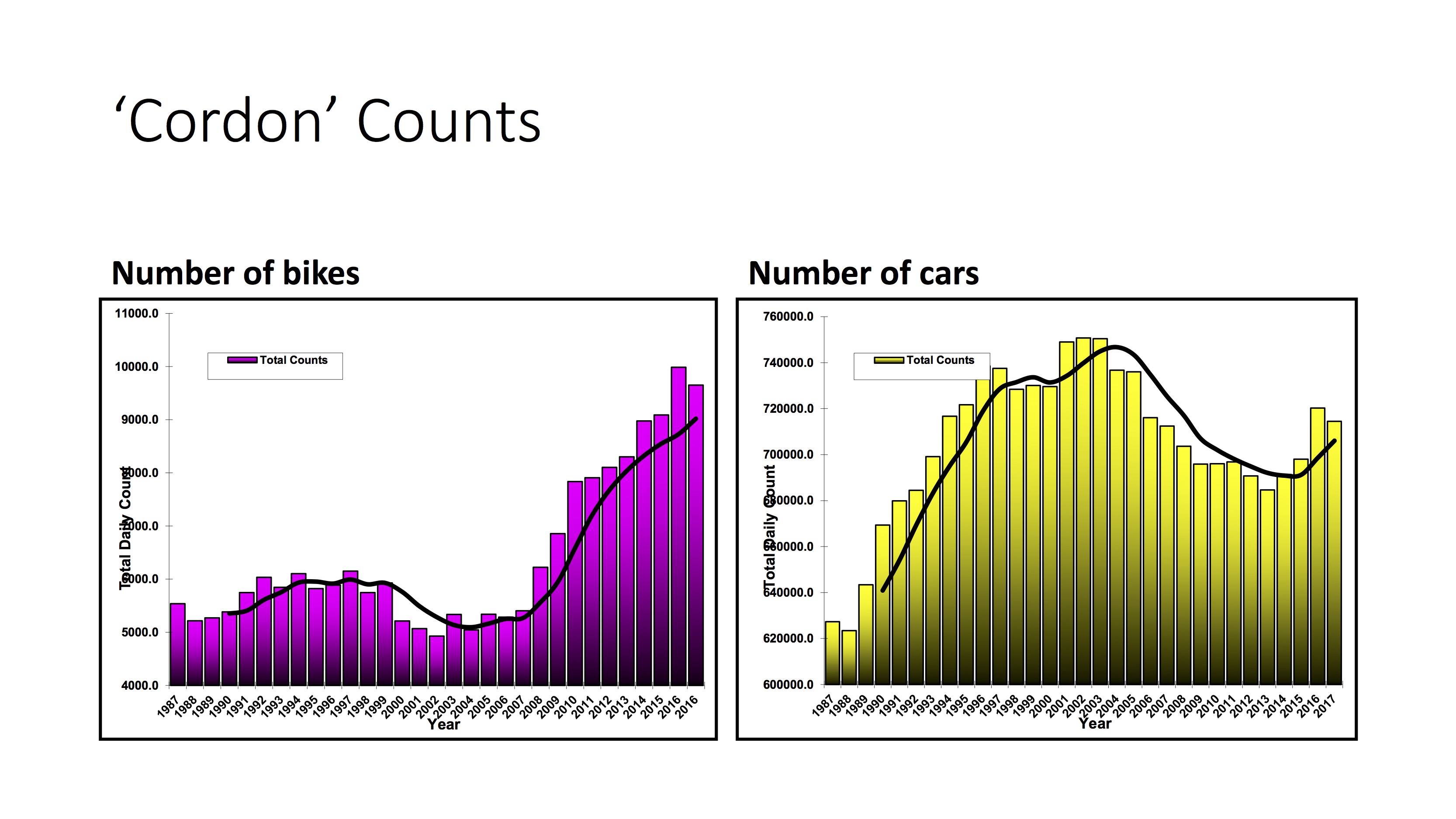
Data on road traffic collisions can be found here. We use an algorithm that ‘clusters’ locations of collisions and resulting injuries which enables us to understand how different areas of the city are performing in terms of road safety. The algorithm takes into account the number of injuries in different years and we use a ‘rolling’ five year average to ensure that the impact of collisions and resulting injuries are understood but that one incident in a location does not disproportionately distort consideration of ‘hotspots’. Example maps are attached that show the position before the series of changes on Great North Road took place. We have included maps that show injuries to all users of the highway network, and also those specifically on bikes.
Please can you provide details of cycle counts and locations of counters
Information is attached that shows cycle counts for the stretch of cycle route between Broadway Roundabout and Hollywood Avenue. If you would like further information on cycle count data please go to https://gis.gateshead.gov.uk/gatesheadmaps/ctf/app.html. On this website you can view an online map that shows counters and data that can be retrieved directly.
These were the slides that were presented at the meeting on 24th January







A very comprehensive summary, for which many thanks. Can I add three further “action points” by Parklands Councillors please?
1. The recent letter to Melton Park residents was at our specific request, and we’ve also asked the same for each of the following phases.
2. Many people have no memory of all the steps that have been taken. Two years from consultation to scheme may not be long in the eyes of professionals, but is soon forgotten by may people. (The same argument very much applies to the Broadway roundabout. Hardly anyone remembers that the layout now is a consequence of a furore at the time of first consultation about installing 4-way traffic lights and removing the roundabout.) So we’ve asked the Scrutiny Committee to look at the communications process, as part of a wider review of major highways schemes.
3. Design changes are implemented as implementation progresses (the original mis-placement of a sign in the middle of someone’s drive in the Broadway scheme being an example) So we’ve asked for a further meeting with officers to reiterate our concerns about the 30mph speed limit – the current plan is that the permanent limit between Glamis Ave and Newlands Ave would stay at 40mph – and in particular about the safety of cyclists crossing Newlands Ave and the exit of cars uphill from Melton Park into traffic, and the excess speed of taxis using the bus lane.
We’ve been pointing out to residents that the trees being removed from the pavement at Glamis Avenue have already pushed up and cracked the pavement and look like they are having an impact on the stone wall. Elsewhere in the ward, residents have been begging the Council for action on similar tree growth but there’s no money to do it. This is a spin-off benefit because the cost will be met from the scheme. It really could be now or never.
We also hope that one of us will be called to speak on the petition to the Council.
Pauline, David and Robin
What an excellent article. Presenting the background to the scheme, a draft consultation scheme and the feedback from consultation events and associated website. And then following an assessment of the feedback, a revised updated scheme set out for comparison with the previous scheme extract. Basically everything that i was expecting from the City Council, but provided by a group of residents!
Why is it left upto resident groups to fully present this information? It’s no wonder there is confusion, fake news etc. And on this can i de-bunk the issue with regards tree removal. It isn’t 11 or 13 trees being removed, it’s actually 18 now that we are able to view the revised scheme and the changes between Fencer Court and Polwarth Drive, albeit published on the NCC website the week the scheme was due to start. In addition at least 10 other trees will have their rootzones severely affected by adjacent works.
As always and as has been the case with all the other GNR related highway improvement schemes, it all relies upon the detail, the precise detail. If i am reading correctly various amendments were proposed back in July 2016 and then following TRO’s, a couple of amendments made in July 2017. Why therefore do we have to wait until the week the scheme starts on site in order to view the ‘detailed’ plans on the website (or as it should have been displayed, on this website)? NCC have been their own worst enemy yet again and there is no wonder we have had the recent response from parts of the Gosforth and wider community.
Paul, thank you for the kind comments. It would be great if the Coucnil could do this, but having looked around for other Council’s, I’ve not yet found any that do any more than Newcastle so I’m reluctant to be too critical, and most of what you (and everyone else!) ask is well beyond what is required legally. We have made some suggestions, like having a board on site to tell people what is going on, which the Council have done a few times now, but if you spot anything other Councils are doing then please say and we’ll pass it on as feedback.
In terms of tree numbers, I believe not all trees marked will actually be removed but the Council will have to confirm that. They’ve released a statement today to the Chronicle including tree numbers so I’ll add that to the article. As to the wider response, I’m not sure that is inevitable not least as from what we know the scheme will result in more trees being planted than are removed by a factor of 2, which I expect most people would consider to be reasonable.
Thanks for the reply and the NCC update.
Yes we can’t ask Local Authorities for everything and yes from memory some in relation to my work have been worse than NCC, but not many, but in this and other GNR schemes we have seen many shortcomings from them.
Whilst my comments and questions are about processes and information and not simply about tree removal, its interesting to note from the update above, that NCC indicate the removal of three trees directly due to the scheme implementation ie routes of new paths/crossings directly go over the tree stem thereby necessitating their removal. Then when looking in detail at the NCC final plan published on 05.01.18, it is quite obvious that the scheme directly effects 4 trees and also 1 other which isn’t shown on the plan. And then there are 13 other trees which are not even identified on the plan (other than the nine dots south of Glamis Ave) as per all the others. What are the general public to think if trees (in this instance) have been there for 40 + years, mapped and continuously assessed by NCC highways, but then don’t show up on a supposed final plan!
Obviously i’m keen to see cycling infrastructure so my partner and kids can ‘safely’ travel to and from Brunton Park from where we live off Broadway West, abliet in a way reminisent of a skiing slalom. But NCC have had so many opportunities to get both the base information and final plan information right on this and other GNR schemes, it inevitably leaves them wide open to criticism of varying levels, which on ocassion distracts from the good stuff.
Parklands Councillors have circulated a survey direct to over 1000 homes most likely to use the stone bus shelters to determine bus usage and factors which could increase it (including shelters) So far response is just over 20%, but we’ll keep including any as they come in. (Two local traders, Melton Park Hair & Beauty and Brunton Park Post Office have kindly agreed to receive forms to save people the cost of posting them to us at the Civic Centre) The data and comments will be sent to the City Council, Nexus and the North Gosforth Parish Council before the latter’s meeting on Wednesday 21st February., and then will publish online inc here.
So finally we get relevant detailed information after the scheme has started on site in February that supports the revision to the 05.01.18 final plan. Interesting to note that at last they are acknowledging trees to the south of the scheme around McCracken Close as either being removed or retained and the same at Glamis Ave. They are now not just arbitrary dots on a plan. And whilst they are ‘moving’ the cycle lane between McCracken Close and Polwarth Drive to ‘save’ two further trees, the four large trees south of Newlands Ave near to Park Drive aren’t even shown on the new plan again (as being removed), or even exist in the tree survey schedule. Do we know why these are going, services perhaps? Why not move the cycle path around them as shown in the original plan? So i make it that they are now removing 14 trees with 1 being replanted. 2 further trees are being ‘saved’ by moving the cycle path and 5 are being saved near to Glamis Ave. Consultation and ongoing engagement should always start with accurate baseline information. Lets just say that after a ‘consultation’ plan, 2 ‘final’ plans and the scheme on site, NCC are nearly there.
Hi again Paul,
The slides you refer to were presented at a meeting for the Gosforth Traffic team and petitioners who were objecting to the loss of trees on 24th January so this was in advance of work starting, and similar information has also been on the Council website for a while. At that meeting, which SPACE for Gosforth also attended, the Officer responsible for trees talked us through the different trees and what was planned for each of them. He also talked us through plans for planting new trees. No further objections were made at the meeting and the Council have proceeded on the basis that Gosforth Traffic and the petitioners were ok for them to do so.
By my calculation 5 trees are affected by the cycle scheme of which one is healthy / moderately aged, one young tree which has been replanted and the other 3 have various issues that would have led to them having been removed at some point in the near future anyway.
Another 5 trees are being removed though only has a matter of convenience to allow the work to be done at the same time. These include 4 by Glamis Avenue that are being removed in order that the remaining 5 trees in that location have a better chance of survival.
Using the scheme budget, the Council plan to replant I believe > 20 new trees during the planting season next autumn / winter mostly alongside the new cycle path south of Glamis Avenue.
The Council did not mention the 4 trees next to Park Avenue so I don’t believe they are being removed. From the plan it looks like the cycle path goes inside the trees.
https://www.newcastle.gov.uk/sites/default/files/wwwfileroot/parking-roads-and-transport/gnr_long_plot_dec_17_0.pdf