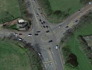
In this post we look at the Environmental Impact Assessment Screening & Scoping Report (“the EIASSR”) lodged as part of the planning documents for the original plans for the Blue House roundabout and Jesmond Dene Road. The EIASSR’s aim was to identify the different types of environmental assessments that would have been needed had those plans gone ahead.
Despite the plans not going ahead, SPACE for Gosforth wanted to look at the EIASSR as it contains a substantial amount of information about the ecosystem of the Town Moor and its relationship with the surrounding communities. In short it gives us an insight into the many different reasons why Newcastle Town Moor is not only special to the surrounding communities, but an iconic location known throughout the North East of England and beyond. This information remains important as alternative plans for the Blue House roundabout and Jesmond Dene Road are formulated.
 THE EIASSR also contains information about the background and scope of the previous plans – again important information for new plans. As the previous plans were so comprehensively rejected, one question relating to them was whether it was the plans themselves that were flawed, or the objectives that the plans aimed to fulfil? And are there any issues not included in the EIASSR that ought to be looked at when alternatives are created?
What is the EIASSR and who wrote it?
 The EIASSR was lodged with Planning Application documents for the Blue House Roundabout and was prepared for Newcastle City Council by AECOM. Its purpose was to identify which environmental reports would be needed to assess the impact of the plans for Blue House and Jesmond Dene Road. The proposals for Haddricks Mill were not considered in the EIASSR.
It was originally lodged in a version dated the 18 July 2016 and then amended during the consultation to the version dated 28 July 2016. The EIASSR contains 17 sections each dealing with a different aspect of the original application or the Town Moor.
What is the wider context of the plans for the Blue House roundabout and Jesmond Dene Road?
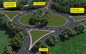
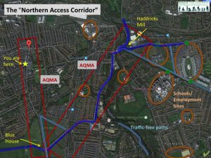 The first section introduces the proposal and confirms that the proposals for Blue House, Jesmond Dene Road (as well as Haddricks Mill) are part of the Northern Access Corridor, which:
“runs in an east to west direction approximately 1 km north of Newcastle Upon Tyne City Centre and is intended to enhance and integrate the major routes into and through Newcastle in the north of the city.” (1.1.1)
The Gosforth section of the Northern Access corridor is shown above.
This section also confirms that the proposals would require land take from Registered Common Land. This would require separate consent, which would be sought in conjunction with the planning application (1.3.2). The version of the 18 July stated that a proposal had been agreed in principle between Newcastle City Council and the Freemen of Newcastle upon Tyne. However, the later version replaced that statement with the following:
“Any land take from Registered Common Land will require separate consent which would need to be sought in conjunction with the planning application. NCC has discussed the issue of a land swap with the Freemen. Currently no agreement is in place as this relies on a detailed design which is not yet in place and is also subject to public consultation. During these early discussions the Freemen of the City have noted that any changes at this location should ensure that the city’s growth and success in future years is secured. Further, that if major changes are made in this location that they should be done sympathetically to the surrounding areas and be designed in such a way as to ensure that further roadworks or changes are not required in this location for decades.” (1.3.2)
What does the EIASSR tell us about the Town Moor?
1. Wildlife
 The EIASSR brings together a substantial amount of information about Newcastle’s Town Moor, and the surrounding open space and communities.
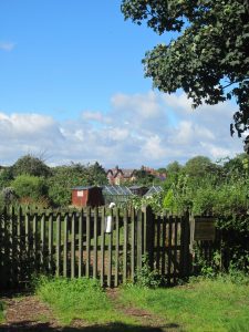
Newcastle’s Town Moor is known to be common land, but the EIASSR confirms that Duke’s Moor, Little Moor and the allotments adjacent to Jesmond Dene Road are also areas of Registered Common Land (13.2.3).
The EIASSR lists the different species that live on the Town Moor (Table 8.1), these include protected species such as:
-
 bats;
bats; - 5 species of birds that are on the red list of birds of conservation concern (skylark, house sparrow, mistle thrush, song thrush and starling) and 3 species on the amber list (swift, housemartin and meadow pipit). Swifts have also been identified as a species under particular threat locally. These classifications result from all native birds in the UK being split into three groups. Red is the highest conservation priority, with species needing urgent action. Amber is the next most critical group. Green are species that occur regularly in the UK, but are not classed as amber or red. The RSPB also explain that with the right action, species can recover and be moved on to the green list. One such success is a bird that has become an iconic bird for Gateshead: the red kite.
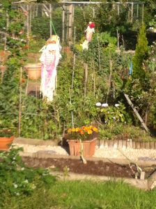
 There are no records of reptiles on the survey area, but the EIASSR states that the Little Moor allotments
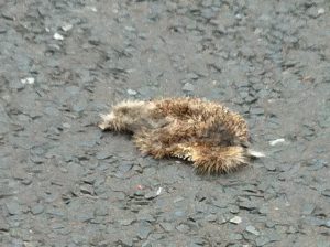
could provide habitat for them, most probably for slow worms, another protected species.- Hedgehogs are also to be found in the area, and while not protected, they have been identified as a species under threat locally. The photograph on the right was taken on Linden Road in Gosforth the same day the article in the last link was published and illustrates the threat to wildlife posed by human lifestyles.
The EIASSR also confirms that the Town Moor is a site of local conservation interest (8.2.6) and that there is a wildlife corridor that runs from the Town Moor, through the junction of Jesmond Dene Road and Osborne Road and the Little Moor to the Metro line (8.2.7). The previous proposals for the Blue House Roundabout were identified as potentially having these effects on wildlife:
 construction phase: loss or degradation of habitat; mortality of protected species; damage to retained trees (8.4.1);
- operational phase: severance / fragmentation of habitat and disturbance due to changes in lighting and traffic volumes (8.4.1).
2. Cultural heritage and historical significance
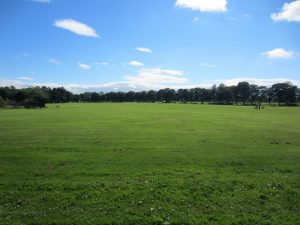 The EIASSR also acknowledges the Town Moor’s historic status, by noting that it was granted as common land by King John around 1213 and that its boundaries are largely unchanged (Appendix D).
The EIASSR also confirms that Newcastle City Council recognise that the Town Moor is a special space and that it is one of 6 areas in Newcastle considered to be of “exceptional landscape value” and that development that will “demonstrably harm” it will not be allowed (7.1.3). Figure 7.1 in Appendix C confirms that both Duke’s Moor and the Little Moor are included in the definition of “exceptional landscape value”. All 3 moors are also designated parkland (7.1.8), and the Town Moor and Duke’s Moor are considered to be an “Area of Countryside Character” (7.2.7).
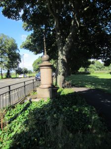
Section 6 gives details of the buildings and other items of cultural heritage in the area of study, but concludes that they are “low value” (6.3.1), with the exception of the Town Moor Boundary Stone (pictured right, a grade II listed building deemed “medium value” by the report), the Town Moor itself and the conservation areas of Gosforth and Jesmond Dene.
The Blue House itself is a locally listed building, as is the Laing Memorial Fountain (pictured left), and both of these could have been affected by the previous proposals (6.4).
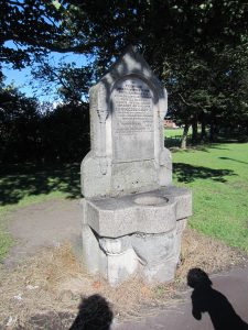
Another locally listed building close to the Blue House is the Colvill Memorial Fountain (pictured right).
One omission from this section is that it does not acknowledge the Town Moor itself, or the scheme of planting of the trees, as an items of cultural heritage. The Moor itself does have historical and other significance within Newcastle and the wider region, and has been damaged by previous development, particularly by the building of the A167(M).
What threatens the landscape of the Town Moor?
1. Japanese Knotweed
It may seem surprising that an area of exceptional landscape value could also be “land in a contaminated state”, but the Town Moor is due to the presence of Japanese knotweed. One risk of the proposed construction works is that they risk spreading this species (8.4.1). The EIASSR does not contain any information about action being taken to remove this species.
 2. Air pollution
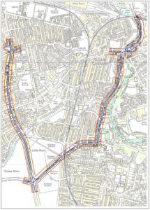
The Blue House Roundabout is within the South Gosforth Air Quality Management Area (AQMA) (see map right for the extent of the AQMA) due to the high levels of nitrogen dioxide in this area. The readings quoted in the EIASSR confirm that levels of this pollutant are decreasing, however some readings are still in excess of the air quality standard, and the AQMA is still required (5.2.3).
The EIASSR considered that proposed development had the potential to cause air pollution which would have affected public health in the following ways (5.4.1):
- changes in traffic flows/composition/speeds could affect pollutant concentration
- changes in location of sources of air pollution due to changes in the road layout could also affect pollutant concentration, and
- construction related dust emissions could affect dust deposition rates.
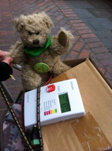 The EIASSR does not include any other pollutants as the AQMA has only been declared for nitrogen dioxide. However, SPACE for Gosforth’s own monitoring of pollution on Gosforth High Street (one of the roads leading to the Blue House roundabout) detected levels of another pollutant, fine particles, that were always above the WHO levels for that pollutant, and at times above higher EU level. Nor does the EIASSR include any discussion of the many medical conditions where air pollution is thought to be a contributing factor.
3. Noise
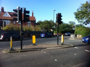 The previous proposals for the Blue House and Jesmond Dene Road had the potential to increase noise levels, both from construction work and any increase in traffic (10.4). For more information about current noise levels in Gosforth, Defra have an interactive map showing estimated noise levels from major roads, railways and industrial premises. The EIASSR confirms that the junction of Jesmond Dene Road and Osborne road is within an noise important area associated with the metro line (10.2.1).
4. Water
The original proposals had the potential to affect both the drainage systems on the Town Moor and the Ouseburn (11.4.1), to cause water pollution to surface water (11.4.3), and also to adversely affect an acquifer (11.4.4).
What is missing from the report?
In this section we look at aspects of the Town Moor that were not included in the report, but may be relevant considerations for any future proposals.
1. Cows
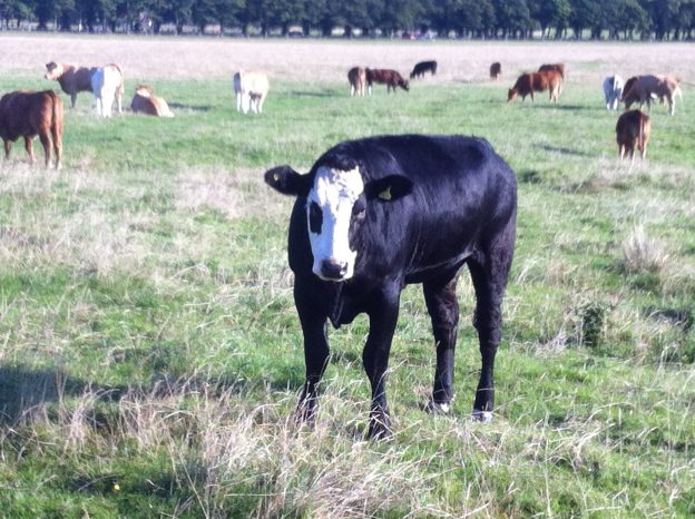
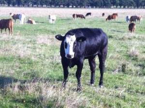 One famous aspect of the Town Moor is its use for agriculture, as its presence in the city means that cows can be kept very close to the city centre. There may be potential to develop this use of the Town Moor. Shortly before the proposals were announced Chi Onwurah MP, who represents Central Newcastle, had suggested the option of promoting Town Moor Beef to showcase the Town Moor.
 2. Community leisure use
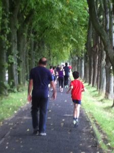
The Town Moor hosts a wide range of community sports clubs and activity. These include the Newcastle Parkrun, Town Moor Junior Parkrun, Newcastle Running Club, Gosforth Road Club Go-Ride Section and North East Marathon club. It is also used by the universities and nearby schools.
3. Charity and commercial use.
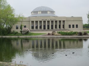 The Town Moor and the neighbouring Exhibition Park are used for many charity and commercial events during the year. The most famous is the Hoppings, but there are also many sporting events and festivals such as the Race for Life, the Big Fun Run, the Newcastle Mela, Newcastle Pride.
There are also 2 businesses operating from Exhibition Park, Wylam Brewery and the Cafe in the Park.
4. Children.
 The Town Moor is an important location for children in Newcastle with its combination of farmland (the Town Moor and Duke’s Moor), playing fields (the Little Moor) and park facilities (Exhibition Park). The are also other facilities in other areas of the Town Moor such as Nuns Moor. The previous proposals would have removed a substantial amount of the playing fields.
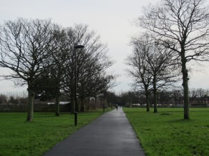 The cycle routes on the Little Moor and the Town Moor potentially form a comparatively safe cycling corridor for children attending both Jesmond schools (eg West Jesmond Primary School, Newcastle High School for Girls, Newcastle Preparatory School and Royal Grammar School), and Gosforth schools (eg Archbishop Runcie Church of England (VA) First School, Gosforth Central Middle School, Gosforth Academy and Newcastle School for Boys).
5. On road cycle commuting
 The EIASSR describes cycling through the Blue House roundabout as:
“There are currently no formal cycling facilities such as dedicated cycle lanes. Traffic data provided by WSP Parsons Brinckerhoff suggests that large numbers of cyclists currently utilise the existing at grade crossing points on Grandstand Road and Jesmond Dene Road.” (12.2.6).
There is no discussion of the numbers of cyclists who currently cycle on the road itself, or the need for a fast, safe and direct cycle lane to the city centre to encourage cycle commuting from outlying areas.
6. Dog walking
Many dogs such as Toby and their owners enjoy using the Little Moor, Duke’s Moor and the Town Moor.
7. Induced Demand
The concept of induced demand (that more capacity leads to more traffic) is not discussed in the EIASSR, which predicts that motorists will experience a positive effect benefiting from a reduction in congestion and journey time (12.4.6). No explanation or evidence is given for this claim.
8. Understanding of pedestrian and cyclists needs.
Again the EIASSR portrays the proposed route for pedestrians and cyclists as having a beneficial impact (12.4.8). This view was not shared by many who objected to the proposals, who did not think that the proposed route was direct or easy for pedestrians or cyclists.
8. Adequacy of rail services.
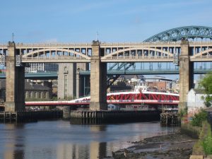 Another omission from the EIASSR is the consideration of whether the local rail services that service the destinations north of the city are adequate.
For example, the journey time between Newcastle Central Station and Cramlington is 12 minutes – less that the the journey time from Newcastle Central Station to the Regent Centre by Metro. The South East Northumberland Rail User Group (SENRUG) is campaigning to improve the service on the Cramlington and Morpeth line, in particular by running services between 18.20 and 22.00 in the evening, and by introducing a Sunday service and by building a new station at Killingworth. SENRUG’s other campaigns include reopening the Ashington and Blyth line, and building a new station on the exit
9. Adequacy of Park and Ride
Another omission is the consideration of the use – or under-use – of Park and Ride. Motorists who drive into the city via the Great North Road and Haddricks Mill have the opportunity to use several Park and Ride facilities as an alternative, for example the Metro at the Regent Centre or Four Lane Ends, or the bus at the Great Park.
A future for the Town Moor?
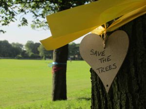 Ultimately the EIASSR provides it readers with a deeper understanding of our Town Moor. It chronicles many of the reasons why Newcastle Town Moor is so beloved by people in the surrounding communities, the city as a whole – and the wider North East region and beyond.
The EIASSR also records the pressures on this very special place.
Understanding both of these aspects of the Town Moor is crucial for anyone making decisions about it future, as if we fail to fully comprehend this we risk losing one of the great things that makes our city special.


It is possible to take a more radical view of the Town Moor and its possible future eg https://sandyirvineblog.wordpress.com/2016/05/31/newcastles-town-moor-green-it/
I’ve still got an image of a lake that proposed for the centre of the Moor in the ealry 60s. The Moor compares badly with similar areas in, say, Paris, which are more wooded and have higher biodiveristy value. Pretty pictures of cattle grazing might be put next to what comes next in their lives, the abattoir. There are also conflicts between recreational use and wildlife. I used to talk my children when they were young to watch owls on the Moor but those birds were driven away by people flying toy powered gliders. So we have to decide what is the land for. The role of the Freemen in the city has been far from benign.
Pingback: Town Moor – Making History Northumbria University: Objects Places and People